Rapid bus services
Rapid bus services link town centres and other key destinations, running at least every 15 minutes between 7am and 7pm on weekdays and every 15-30 minutes at other times (including weekends).
Travel from the city to Woden (R4 and R5) or Belconnen (R2, R4 and R5) in about 20 minutes.
Local bus services
Local bus services operate every 30 minutes or less on weekdays, connecting the region’s suburbs to local shops and the city.
Light rail services
Light rail takes only 24 minutes to get from the city to Gungahlin via Dickson and Mitchell. It operates every 5-6 minutes (peak periods) or 10-15 minutes (off-peak periods) on weekdays, and every 15 minutes on weekends.
MyWay+ retail outlets
Visit a retail outlet to:
- get a standard (adult) or concession MyWay+ travel card
- top up your MyWay+ travel card
- update your concession status.
Central
Central MyWay+ retail outlets
City
Name | Address |
|---|
|
BP Braddon
|
2 Lonsdale Street, Braddon
|
|
Daily Market Groceries Kambri
|
The Australian National University, Joplin Lane B156-B1 Kambri, Acton
|
|
EzyMart Northbourne
| Shop 2 Jolimont Centre, 65 Northbourne Avenue, Canberra
|
|
Supa 24 Convenience
|
2 Mort Street, Canberra
|
|
The Corner Market
| Shop 1, 113-119 Marcus Clarke Street, Canberra
|
| 21 Capital Mart | Shop 2, 21-23 Marcus Clark Street, Canberra |
Inner north
Name | Address |
|---|
|
Ainslie Newsagency and Post Office
|
Shop 1, 3 Edgar Street, Ainslie
|
|
BP Watson
|
110 Federal Highway (corner of Federal Highway and Antill Street), Watson
|
|
Dickson Newsagency
|
6 Dickson Place, Dickson
|
Inner south
Name | Address |
|---|
|
BP Express Kingston
|
77 Canberra Avenue, Kingston
|
|
Deakin Newsagent
| Shop 2, 4 Duff Place, Deakin
|
|
King of the pack Majura Park | T18 Majura Park Centre, 18-26 Spitfire Avenue, Majura Park
|
|
Manuka Newsagency
|
36 Franklin Street, Griffith |
You can also order and manage your MyWay+ travel card, including concession status, online through the MyWay+ account.
E-scooters
Shared e-scooters are available for hire throughout central Canberra. Hop on and travel between central Canberra, Belconnen, Gungahlin, Woden, Weston Creek, Molonglo and Tuggeranong.
E-scooters are a popular active travel option which help to shift people away from car dependence, better connect them with public transport and introduce them to their local network of shared paths. They are convenient, accessible, environmentally friendly and fun.
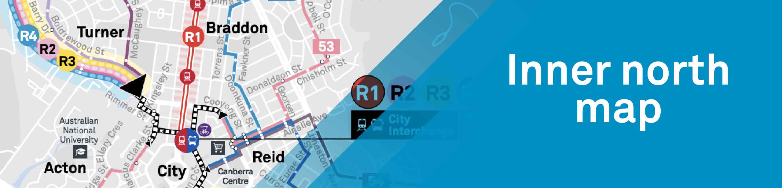
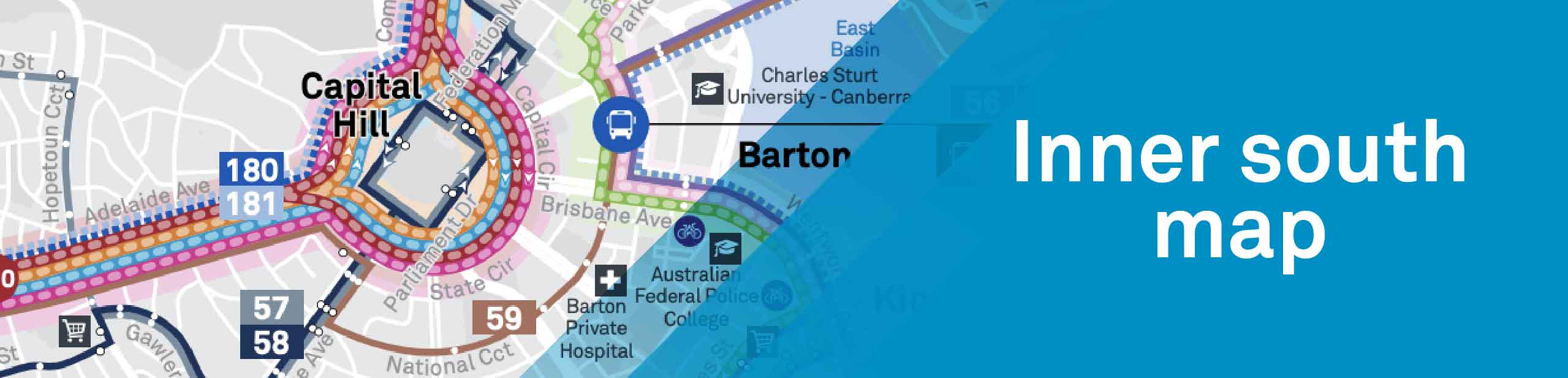
Maps
Click on the Inner north map (PDF 519.3 KB) or the Inner south map (PDF 489.5 KB) below to view bus routes.
Schools
Reduce congestion and increase safety around schools by walking, riding or using public transport. See schools for more information.
We’re going electric
A zero-emission public transport system is a critical step in achieving a sustainable, resilient future for our city and environment. It will deliver a smoother ride, healthier streets, and lead the way to a more sustainable future. Read the Zero-Emission Transition Plan for Transport Canberra to find out more.
Cycling and walking
Take advantage of the scenic cycle routes that connect the City to neighbouring town centres. These include:
- C1 (City to Gungahlin) `
- C2 (City to Queanbeyan)
- C3a (City to Belconnen via Town Centre)
- C3b (City to Belconnen Town Centre bypass) Your 2022 public transport, cycling + walking guide
- C4 (City to Tuggeranong via Woden)
- C6 (ANU to Dickson)
- C8 (City loop) and LBG (Lake Burley Griffin Circuit)
- C4 (Tuggeranong to City via Woden)
- C5 (Tuggeranong to Belconnen via Weston Creek).
Bike rails and bike cages are located at many public transport stops and stations, and you take your bike onboard light rail or use the bike racks on the front of buses.
Parking
For information about parking including a map of city car parks see the parking page.